Trondheim is (today) the third largest populous municipality and city in Norway. The city Trondheim was founded in the year 997 by Olav Trygvasson and has gone through numerous transitions over the centuries. There are about 15,000 employees in the municipality today. We are totally 45 in the mapping division (unit for mapping and architecture), of which a significant portion work directly with mapping activities. In addition to establish and update technical maps and maps and registry for planning purposes, we also provide and produce a variety of thematic maps and map solutions for other units in the municipality as well as for the public and external organisations. We also produce 3D models for specific projects. Some examples of maps we provide are as follows:
Citizen participation maps
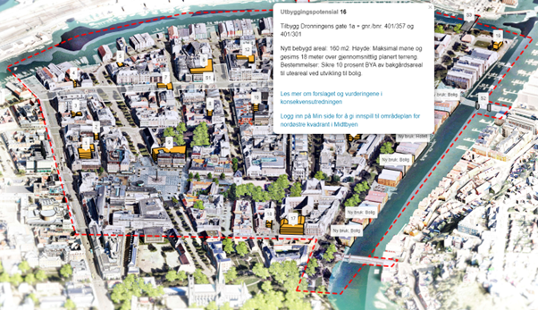
Hearing: Possible developments in the city center. From 3D model to isometric interactive 2D map: https://sites.google.com/trondheim.kommune.no/framtidstrondheim/plan-for-sentrumsutvikling/omr%C3%A5deplan-for-nord%C3%B8stre-kvadrant-i-midtbyen
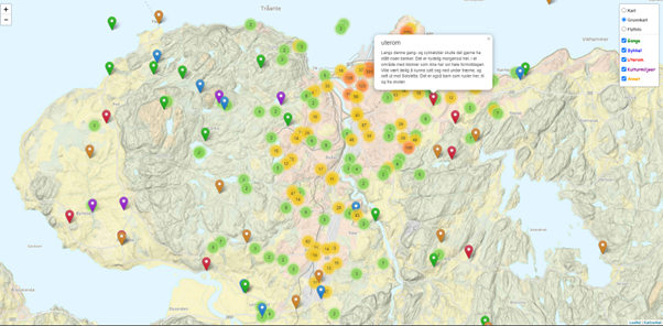
Low threshold click and comment – what do you think will make the city more attractive? 3500+ comments handled with Leaflet clustering: https://kart.trondheim.kommune.no/medvirkningskart/attraktivitet
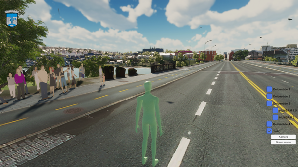
Drone-captured models together with classical 3D GIS came together in Unity to form a virtual tour, replacing the physical tour as Trondheim played host to Nordic City Network during covid.