The Norwegian Coastal Administration (NCA) (video) is a national agency reporting to the Ministry of Trade, Industry and Fisheries, and holds responsibilities in coastal management, maritime safety and emergency preparedness against acute pollution. It is structured around four thematic areas:
Transport, Ports, and Fairways: This department manages, builds, and operates the physical infrastructure related to transportation, including conducting analyses and fostering knowledge within the sector.
Navigation Technology and Maritime Services: Responsible for the management, development, and operation of the digital infrastructure, this department monitors and controls traffic while overseeing the pilotage service.
Environmental Preparedness: The NCA actively works towards preventing and minimizing the harmful effects of acute pollution, prioritizing environmental protection.
Pilotage Service: Ensuring the safety of maritime traffic and safeguarding the environment, this department places pilots on vessels and provides crews with necessary knowledge of waterways.
While geographical data and mapping play a significant role in the daily operations of many of the approximately 1000 NCA employees, these competencies are primarily housed within a newly established cross-cutting department, Digitalization and Innovation, created in 2021.
By bringing together industry experts, IT specialists, as well as developers, system architects, designers, and geographers, the team supports the digitalization of the NCA’s internal and external services. Many of these services rely on geographical data or use interactive mapping tools as front-end interfaces to serve our users’ needs. Below are three examples that show the depth and breadth of our map-based tools.
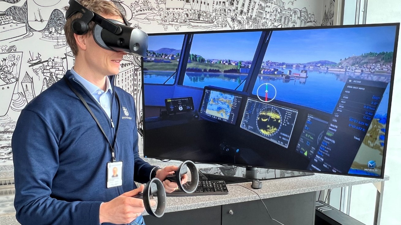
1. Digital Twin of the Norwegian Coast
During the COVID pandemic, it became important for NCA to continue training its maritime pilots without requiring them to travel. The NCA developed a virtual reality interface based on available high resolution geographical data (infrastructure, vegetation, elevation, etc.) used to train its pilots on different virtual ships, weather conditions and time of day. In the future, we see that this tool is also extremely useful for other teams responsible to plan and test different changes in maritime infrastructure and fairways.
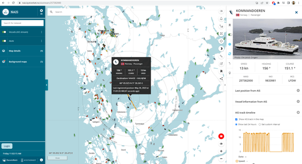
2. NAIS – Real time Norwegian Vessel Traffic
Kystverket is unique in that it operates its own land- and satellite-based AIS network. Life traffic data is used in many of our mapping platforms internally and externally. One example is NAIS, a web-based visualization tool that allow its users to search for ships, tracking and visualize historical data. All this data can be freely downloaded from our services for users who may want to use it for research, analysis, or other purposes.
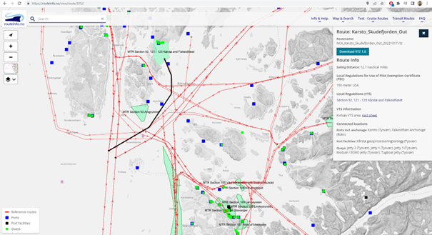
3. Route Info
Route Info is another web-based visualization tool build around a center map. As opposed to NAIS, this tool was developed for a very specific audience: professional ship navigators planning their navigation in Norwegian waters, especially those that may be more unfamiliar with a particular area. The system shows reference routes, ports, ports facilities and quays. The different routes can also be downloaded and integrated into the navigator’s own mapping systems.
Looking forward, we expect all our services to experience increased digitalization in the coming years. This means more automation, and integration with the end user’s own systems and platforms. In terms of mapping, the NCA is seeking to further increase the accessibility and interoperability of our geographical data. Another important aspect of mapping is the efficient communication of geographical information visually. On this front, the NCA is moving towards further standardizing the visual elements of our maps, to ensure a cohesive user experience throughout our platforms.