eMap makes any products where the map is a central part of the end product.
Often, the end product is the visual or cartographic map itself.
This includes, amongst others, street maps, topographic hiking maps, car and tourist maps to
fishing and hunting maps, illustrative maps, information boards, and wall maps.
We have had continuous operations since 1988 and are one of few specialized cartographic
companies in Norway, and we celebrate our 35 year anniversary.
Our main focus is the visual presentation and related products where maps play a central role. This includes ordinary topographic maps, map illustrations in books, wall maps and trailhead maps.
Often, layout is to comply with a graphic profile, and we then strive to make the map itself comply with the same profile as well. We both offer a complete enterprise as well as providing just the map file for other projects.
eMap is a small company, where two experts of cartography are working on map and graphics production as well as following up our customers.
We make maps from geodata via software for graphic use like Adobe Illustrator, Photoshop and InDesign. Most often, we produce print ready PDF-files.
Printing, plotting, and other services are done by subcontractors, with whom we cooperate closely with.
We also make digital products for the Internet. This can be static maps or interactive maps with customized content (Point of Interest).
Other activities include product and production line improvements. We are constantly working on improving map content by looking for new sources of information for our maps. Lately, free Lidar-data has become available for almost all of Norwegian territory. This again enable us to improve the content and visual style of the maps.
We have won awards for our cartographic skills 11 times since the first price in 1997.
Below we present the two of our award-winning maps from the period 2019-2023:
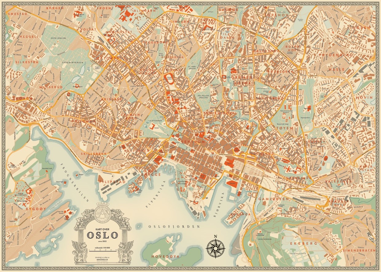
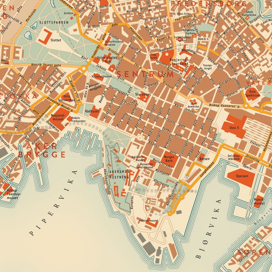
Map of Oslo – in retro design and retro cartography made in 2022
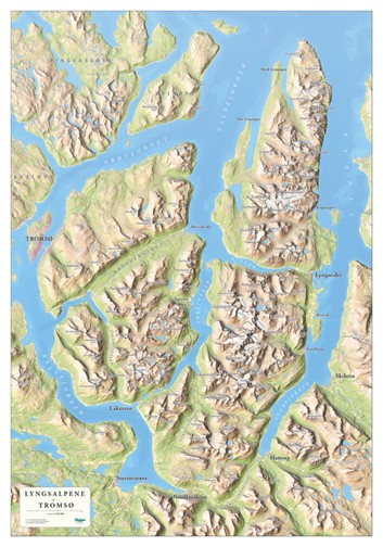
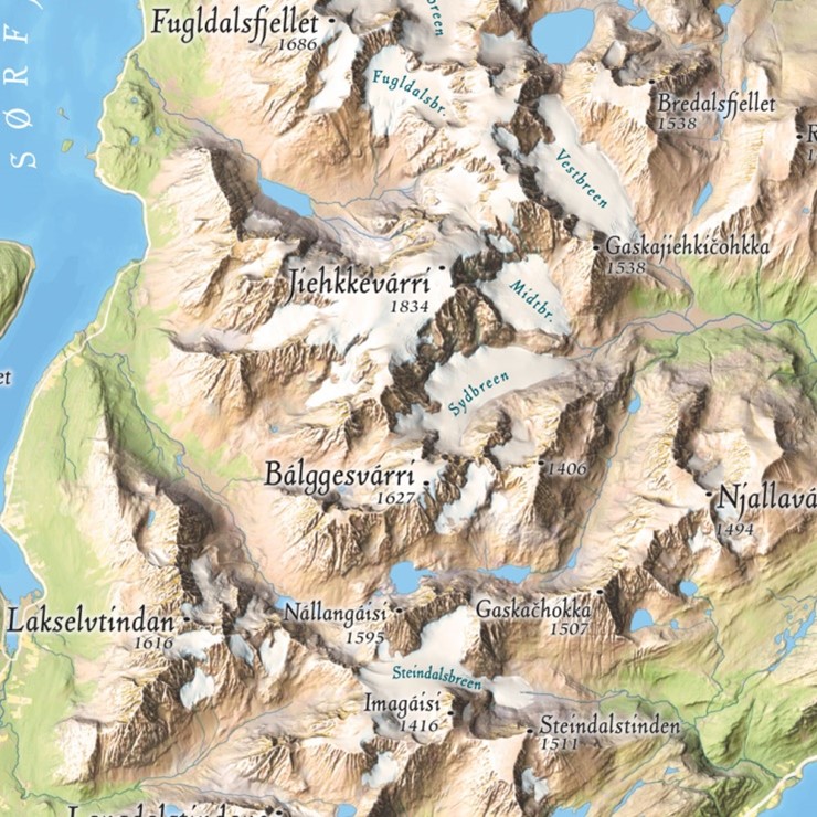
Map of the “Lyngsalpene” – with focus on the shading and sun to make the map easy to see how the landscape looks. The Lyngen alps is a well know ski touring destination in the winter and also as a great place for climbing and hiking in the summer.