NGU is Norway’s national geological survey. We map Norway’s geology and disseminate and present data to meet society’s needs for basic geological knowledge. NGU is an agency under the Ministry of Trade, Industry and Fisheries. Our mission and activities are designed to promote added value and sustainable economic growth. NGU’s headquarters are in Trondheim, and our 200 employees form a highly international work environment. Research is an integral part of NGU’s services and activity, and a prerequisite for performing geological mapping, that complies to international standards, on Norway’s behalf. Over half of the employees are using GIS in their work covering the whole cartographic process from collecting information to delivering user-oriented maps, often as Internet map services in addition to some sort of printed product. NGU makes at this moment 27 datasets and 17 WMS-services accessible through the national SDI “Norway Digital”. The Geomatics and IT group at NGU has 22 employees. The group works on all cartographic activities, with a special focus on developing and managing solutions for data collection, geographic database, and map services.
During the last 5 years there has been great progress in coordinated digitalizing of data collection across fields, and a shift towards more use of light-weight tablets and mobile phones. A map dashboard is made for improved registration and administration of field work.
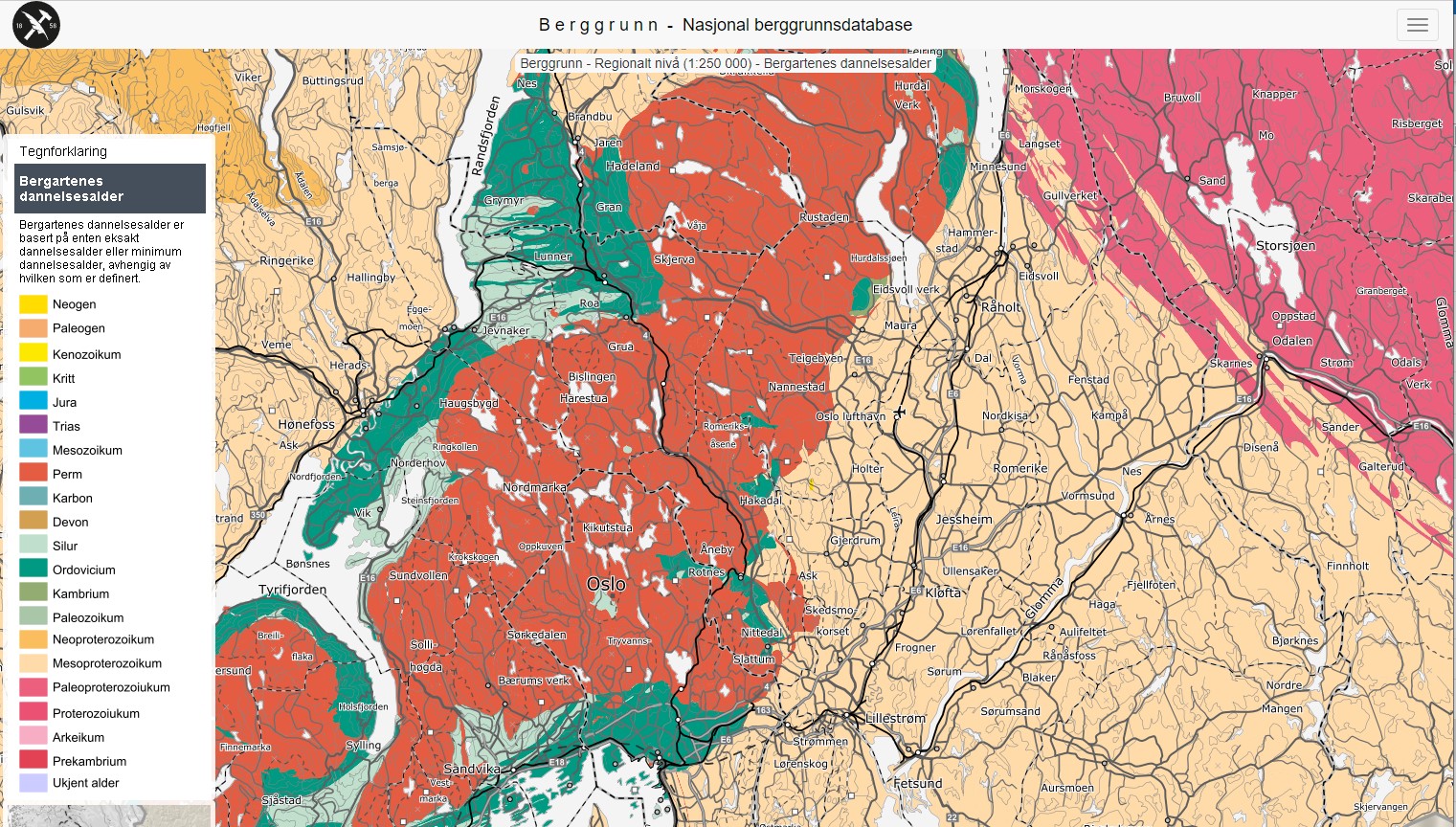
We have a desire for more user-oriented maps to be used in planning through complex classifications calculated from many geological values and properties, but we still have a way to go. A restructuring of the bedrock database makes a range of alternative symbolizations possible, for example for tectonic, age (see Figure 1), and content of chalk, which has a high utility value.
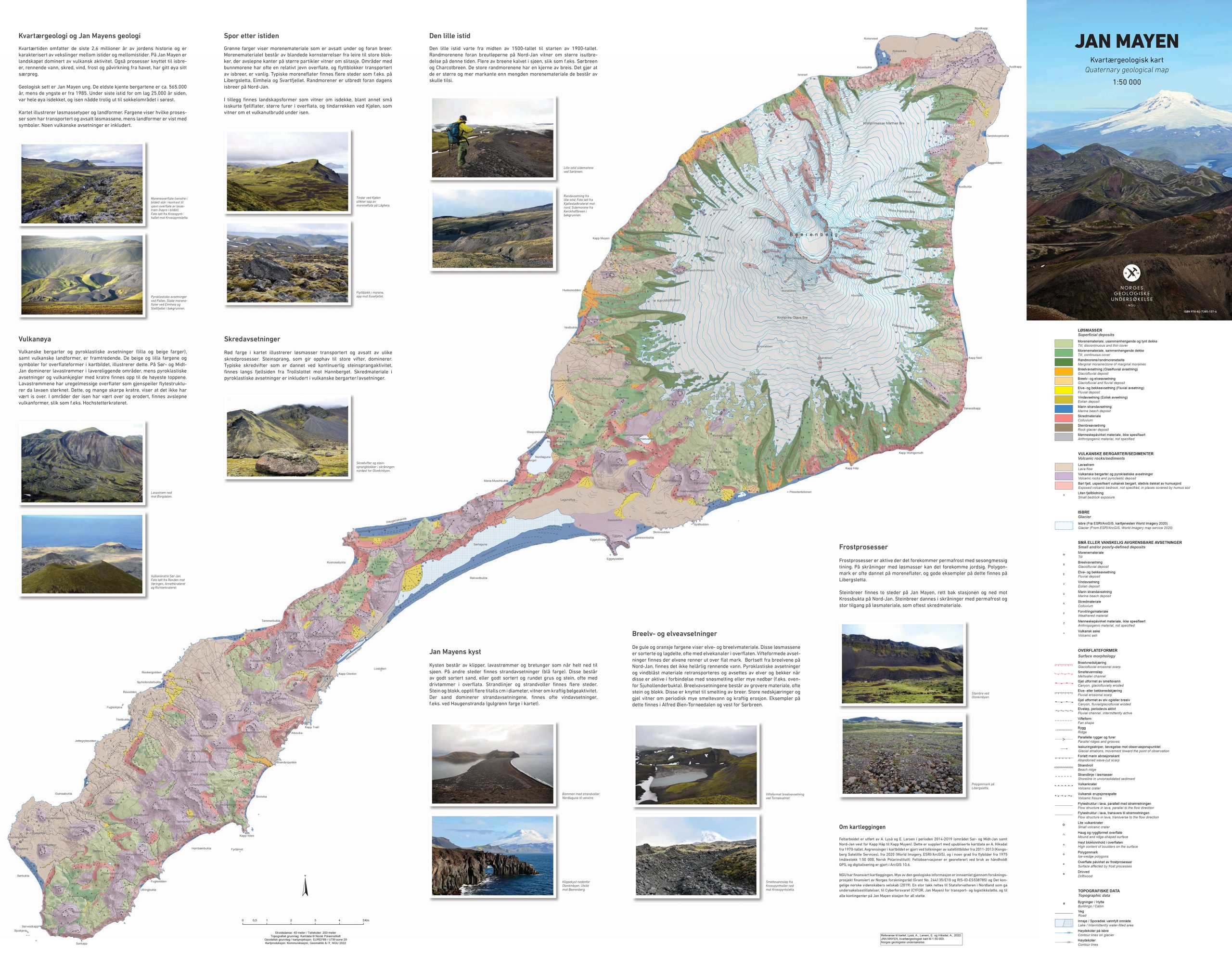
There is very limited production of printed maps. One of the latest printed maps published is shown below (Figure 2), a Surficial deposits map of Jan Mayen, which collected a price in 2022 (Geomatikkdagene.no).
While ArcGIS Software is mostly used for data collection and editing, map production and selected ArcGIS Online Services, Open-Source Geospatial Software are dominant for Map Services and Web Maps. Our web map applications and fact sheets with object properties are now device independent with “Mobile First” philosophy design. The underlying services that support the Map applications will be gradually replaced with the new APIs from OGC and other modern APIs.
We have just renewed our websites that focus more strongly on the user’s need to search, display and download data (www.ngu.no/en). Data and maps can also be found at the national SDI at www.geonorge.no.