www.2286moh.com
The business, 2286moh, is a sole proprietorship based out of Salt Lake City, USA. The name is inspired by the elevation of Snøhetta, the highest peak in Dovrefjell-Sunndalsfjella National Park, the home region of the owner. 2286moh is focused on cartography and map production, especially for print medium, such as brochures, posters, topo maps and books. Most projects are for clients in Norway where a significant amount of mapping data is freely and easily available for download from GeoNorge. The owner worked for the Norwegian Mapping Authority for a year and is familiar with the standards and the quality of the datasets used in the production of maps.
The mapping work for Norway started in 2017 helping the Norwegian Environment Agency finish their pilot project for maps for national parks brochures. The business has grown ever since with many projects spread around the entire country.
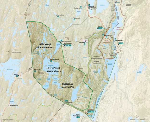
Norway’s national parks map production
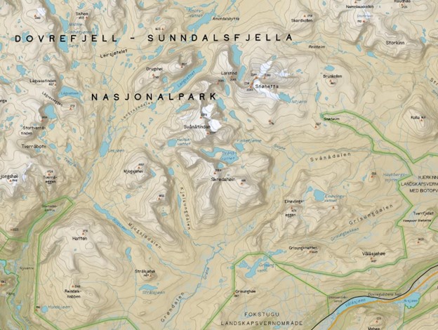
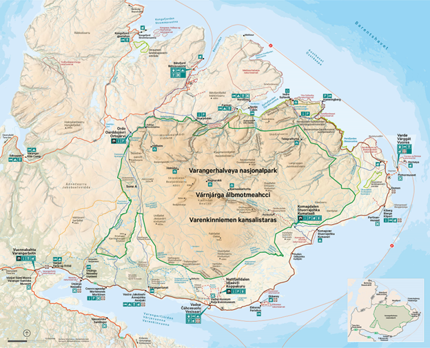
2286moh and subcontractor Trollbinde have, since 2019, had a contract with the Norwegian Environment Agency to produce maps according to their design profile and standards. The design is well developed and can be viewed at https://designmanual.norgesnasjonalparker.no/. The design profile has its own best practices and guidelines for map production and cartography, which we helped develop, https://designmanual.norgesnasjonalparker.no/kart/veiledning-for-utvikling-av-kart. In 2022 the map series for national parks won the jury award for best map at the yearly Norwegian mapping conference ‘Geomatikkdagene’. The maps have their own look and feel and are developed from the bottom up with close cooperation with local resource people. A visitor strategy guides the content of what to add and what to exclude. The maps are overview maps and are not intended to be detailed trail or activity maps. In Norway there are three official languages, Norwegian, Sami and Kvensk (originating from Finnish). For some areas two or three of the languages are added to the maps for place names. It has become important to display all the official languages where they exist.
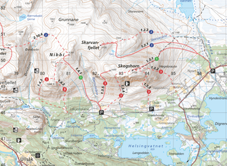
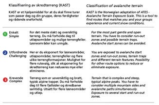
Topo map for ski touring
Ski touring is a growing activity in Norway for Norwegians and tourists from abroad. The 2022 map of the Hemsedal area is a traditional topo map but with suggested ski routes added. The routes are from an internationally certified local guide who has written a detailed book about the routes. The map is a compliment to the book, but can be used on its own. Avalanche terrain classification according to the exposure to avalanches for each suggested route provides important information that the visitor can use in planning a ski tour. The map was made in close collaboration with the book author and guide, and the media production company Fri Flyt.
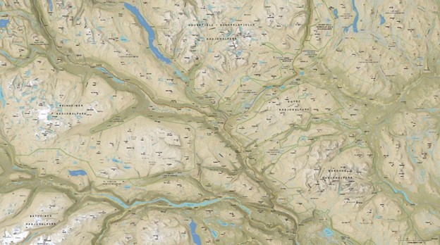
Wall map
This map was made on a low budget for a small sports store in Dombås. It was designed to show all the protected land areas around the town of Dombås. The goal was to encourage conversations about the area and its possibilities, and let the customers explore topo maps for sale for the area of interest.