Avinor is a wholly-owned state limited company under the Norwegian Ministry of Transport and Communications and is responsible for 43 state-owned airports. Avinor provides safe and efficient travel for around 50 million passengers annually, half of which travel to and from Oslo Airport. Over 2800 employees are responsible for planning, developing and operating an efficient airport and air navigation service. Avinor is financed via airport charges and commercial sales. The air navigation services is organized as subsidiary wholly-owned by Avinor.
Avinor’s departments for Information Management and Building and Infrastructure are responsible for most of Avinor’s cartographic production. Approximately, 7-8 employees work with map and chart production, whereas another 8-10 work with geographic information systems and geographical data management. The Building and Infrastructure department also maintains a large number of CAD-drawings.
Avinor’s cartographic production consists of the following mapping and charting products:
• Charts for AIP (Aeronautical information publication): Aerodrome charts, docking charts, aeronautical obstacle charts, en-route charts, arrival and departure charts. These charts are
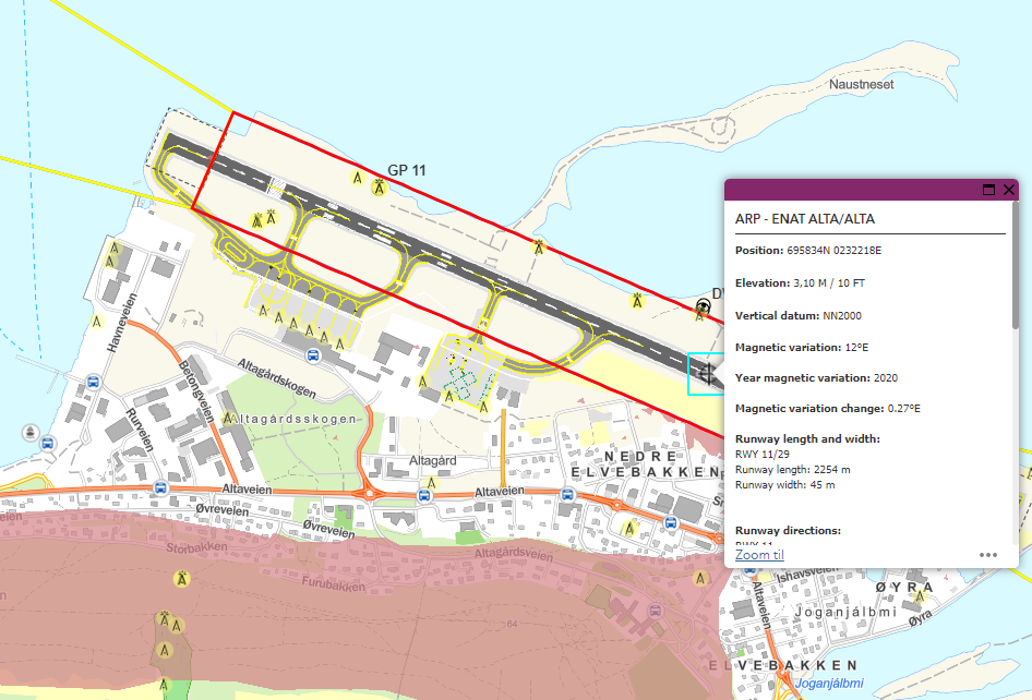
available at: https://avinor.no/en/ais/aipnorway/. An Aerodrome terrain and obstacle chart is also available as an electronic versjon at: https://avinor.maps.arcgis.com/apps/webappviewer/index.html?id=a0799fa96eae462682995fe586877455
(example below)
• Building restriction area maps for each airport. These maps are available at www.avinor.no.
• Charts showing signs and markings.
• Airport maps: airport overview both indoors and outdoors, security, airside safety, emergency planning, utilities, noise pollution, ground pollution, etc. Some of these are published as interactive maps on www.avinor.no.
• Ad-hoc map and chart production.