https://www.kartverket.no/en/at-sea
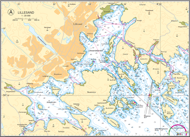
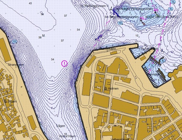
The Norwegian Mapping Authority Hydrographic Service (NHS) is responsible for preparing and updating nautical charts and covers all marine and coastal waters in Norway and around Svalbard, as well as polar waters.
Official nautical charts
NHS is the only authorized producer of official nautical charts in Norway, and vessels over a certain size are obliged to use these charts. As well as cartographical work, NHS is also responsible for information about tidal waters and currents.
Safe navigation
NHS is required to facilitate safe and effective navigation in Norwegian coastal and marine areas. NHS undertakes this task by gathering, administering, processing and publishing official maritime information to a range of user groups.
Charting the ecosystem
While safe coastal navigation takes top priority, NHS’s deep-water database is also useful for other purposes, including coastal zone planning and administration of fisheries. As a supplier of deepwater data, NHS helps to improve knowledge of the structure, mode of operation and status of the marine ecosystem. This knowledge provides a framework for establishing sustainable management of coastal and marine areas in Norway.
International nautical charts
NHS has operational responsibility for Primar, the international nautical chart service. Primar supplies official electronic nautical charts for international shipping for most of the world.
Cartographic activity
NHS is responsible for official navigational charts, both digital (ENCs) and paper charts. Cartography is most appropriate in designing paper charts where there are traditional requirements for readability. Cartography in nautical charts is defined by the standards of the IHO. The NHS also supplies terrain models, raster files, fair sheets and datasets to different purposes. About 20 persons work in the Chart section, updating existing charts and compiling new charts.