Blom Norway AS is a leading supplier in the Nordic market for capturing, processing and modelling of geographical information. Our main fields of business are stereo mapping, DTMs, DSMs, technical maps, forest stand maps, forest inventory, disaster mapping (flood, land slide, earthquakes, etc), orthophotos, 3D-modeling and visualization, oblique and street image libraries. Blom owns rights to unique European geospatial databases of maps, imagery, and models. Blom offers online electronic services within Governmental departments, private and consumer markets. Partners can access our services and create applications based on our databases and location-based services. Blom Norway AS is recognized by its skilful personnel and ability to create new solutions and services. The company has 18 employees, two of which are working with visualization.
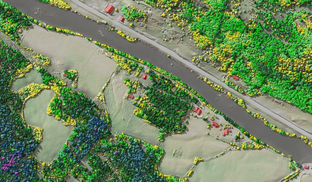
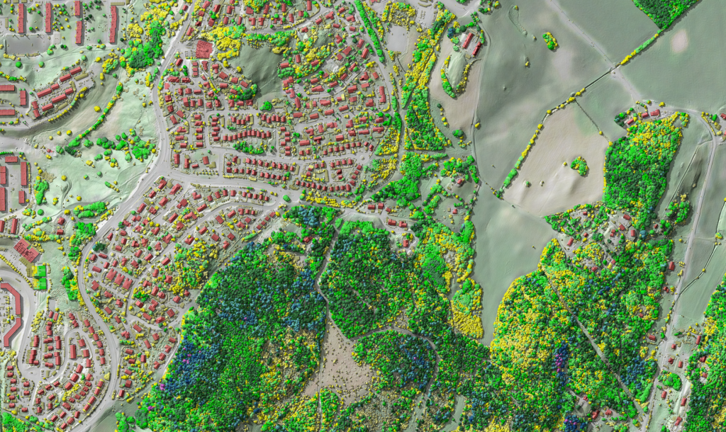
BlomFORESTVIEW™ bridges the gap between advanced LiDAR data and simple use for vegetation mapping. 3D point clouds contain a lot of information, but they are difficult to use in their original format. BlomFORESTVIEW™ is a raster representation of a digital surface model (DSM) that is generated from LiDAR-data and the vegetation is visualized with different colours based on its height. The result is both easy to interpret for non-experts and analytical with respect to tree heights. It can be used -together with aerial imagery- for the delineation of forest stands. Examples of other uses are mapping of small vegetation elements in the landscape and the mapping of vegetation in powerline corridors.
BlomFORESTVIEW™ is based on standard LiDAR data, in Norway this means a density of 2 or 5 points per m2. The visualization will be first produced for Norway, but it can be made for LiDAR data anywhere in the world.